|
Weather links: Sail: Surf: Stormwatch: La
Nina: Profiles: Sky: Polar: Ocean: Fire: Drought: Weatherfacts: Books: Products: |
Volvo Ocean Race Weather links for the South Pacific and South Atlantic Routing notes for Leg Four: Auckland to Rio Volvo Ocean Race contents page February 22: Nail biting finish after 6700 miles of sailing, with fickle winds dominating from the Falklands to Rio. February 12: Clear run to the horn keeps fleet intact, but harsh squalls take their toll on gear. February 6: Blocked high and cradled low challenge the fleet on their way south. January 23: Blocked high forecast to create a slow start from Auckland - a repeat of 1997 re-start from Auckland Nail-biting finish after February 22, 2002 It was another hot and steamy night in that carnival called Rio when Illbruck literally drifted across the finish line on February 19, 23 days out of Auckland. The lack of wind close to the Brazilian coast belied the wild ride these sailors had experienced earlier in leg four. But what made this leg remarkable was not the solitude of the Southern Ocean, or the fickle nature of winds off Argentina and Uruguay - all that was a known commodity. This race was unusual because the fleet never separated. After 6700 miles the first five yachts arrived in Rio within eight hours of each other - places 2-5 arrived within three hours: Djuice Dragons, Tyco, Assa Abloy and Amer Sports One, in that order. If SEB and News Corp had not suffered gear damage they, too, would have been right up there with the leading pack. Only the girls aboard Amer Sports Too were well behind with no gear damage, after choosing a more northerly route in the Southern Ocean. That sensible approach meant the girls ended up sailing in a different weather system with no hope of catching their fellow Volvo sailors. From the Falklands north From Cape Horn, routing decisions took on a whole new level of importance. Racing through the Southern Ocean required courage and seamanship - skills which only a few of the best sailors possess. But when it came to weather routing the biggest challenge on this leg involved positioning the yacht correctly between two big systems. It was all a bit like hitting a barn door with a water balloon. Once the fleet leaders rounded Cape Horn, the gloves came off - literally - and routing came to the fore. The south-east coast of South America is a tricky place, with stalled long wave troughs close to Brazil and numerous trough lines east of Uruguay and Argentina reacting with every cold front that rounds the horn. Bubbles of low and high pressure create a race course riddled with pot holes capable of holding a winning yacht idle, long enough for those behind to catch up and challenge for the lead. That is exactly what happened on this leg, except that Illbruck was fortunate enough to stay out of most wind holes. Amer Sports Too, on the other hand, suffered badly. She was right up there in second place with Tyco at the horn, yet finished fifth at Rio. Just 24 hours prior she was equal third. What happened? No one sailed too close to the southern Argentine coast. An approaching cold front meant wind flowed from the north-west so the routing menu offered a choice of sailing hard on the wind, leaving the Falklands to starboard, or ease sheets and leave the islands to port. As if to illustrate this range of tactics, Illbruck, followed by Tyco, Assa Abloy and News Corp sailed west of the Falklands while Amer Sports Too and Djuice Dragons sailed east. Dodging wind holes By the time the fleet converged east of Rio de la Plata, neither tactic proved decisive. Amer Sports One sailed further - but faster, while Illbruck hardened sheets and cut the corner - at the expense of speed. But at this point - east of Uruguay - the race got tricky as the fleet ran into a series of fickle trough lines. Between February 12-14 two cold fronts crossed the race course, each one teasing a patch of cold upper-level air over the mainland out into the South Atlantic like a spinner fingering raw wool. Each front literally enhanced these low pressure troughs, with the result being windless holes at the surface. Where exactly are these holes? Without real-time Quickscat readings, or something similar, it is impossible to tell for sure. Forecast models are improving out of sight, but on a scale of less than 60 square kilometres, results get very fuzzy. Boats, therefore, tend to pick a slot and head for Rio. Amer Sports Too found one and tactician for leg 4 Paul Cayard relates the frustration: "We just spent six hours becalmed. I think it will have happened to a few others also but maybe not all. A low bubble formed right over us today and inside it there was no wind here. This is not uncommon around this area. We have the tail of the Brazilian current converging here with the Falklands current...bad stuff happens here all the time. "These things have the potential to change the face of the leg. If it had squatted on Illbruck we would have had a restart. It seems like it landed on Tyco and us the most, so Illbruck has sprung further ahead and News Corp and Djuice have caught up to us. "We are looking at the brand new weather map for that time (one hour old, so after we were already sitting becalmed) and they show nothing but a nice southwesterly gradient of about 17 knots. This is where a bit of luck comes in handy. We shall see on the sked how bad the damage was but for sure we lost to some. "When you are becalmed, you work your ass off, believe it or not. You change sails, stack and unstack, look for breeze by sending guys up the rig ... it is not an idle time. It is a desperate time. You know you are losing to someone at the rate of 14 miles per hour. You have to find a way out and most of the time there is nothing you can do but wait for Mother Nature to take her course. She has now and we are off again doing 15 knots." February 14, 1800mgt Image courtesy Intellicast Cold fronts cross the fleet as seen in this infra red image, teasing trough lines out into the South Atlantic. You can clearly see a large trough line north of the fleet. as well as ski but smaller ones cause just as much damage when positioned over a yacht. A stalled long-wave trough can be seen stretching south-east from Rio. Surface winds south-east of
Uruguay Image courtesy MaxSea and Volvo Ocean Race This map, showing wind strength south-east of Uruguay, clearly shows the affects of trough lines on surface winds. While skill rates highly, threading through these wind holes is to also trust in fate. Disaster for News Corp On February 14, east of Argentina's Golfo San Matias, just 60 miles separated the first five boats, after 17 days and 6000 miles at sea. This was proving the closest leg in race history. Setting the fleet boundaries were Newscorp in the west and Djuice Dragons in the east. News Corp co-skipper Ross Fields was confident of retaining third place into the finish ... until disaster struck. Like SEB and Tyco before them, News Corp fell victim to rudder failure. The big blade sheared off below the hull while the boat was shy-reaching at 22 knots of hull speed. No doubt the team's rudder was weakened in that collision with a bergy-bit way back on February 5, but no one will know for sure because the critical evidence lies on the bottom of the South Atlantic. Are Volvo 60 rudders the Achilles heel of this fleet? After Tyco's failure south of Cape Town and SEB's similar retirement en route to Hobart, people are asking questions. But the boys at Farr Yacht Designs, the firm which created this yacht and built the majority of boats in this race, disagree. All three failures occurred for different reasons, according to Russell Bowler, the firm's vice president. "They're completely different incidents that happened to effect on one thing," he told race headquarters. "The first, Tyco, was, I believe, a building issue. The second, SEB, was the rudder coming out of the bearing. And the third, News Corp was after a collision with a chunk of ice, which probably damaged it." Like any grand prix race, gear failures will make or break a winning combination. High pressure fills in Following a series of cold fronts, high pressure fills in east of Argentina stamping its influence on ocean airs all the way to Rio. Those pesky trough lines, meanwhile, evaporate into thin air. The big anticyclone affects fleet leaders with winds at first from the south-west, backing south-east with its windless centre threatening to gobble up the girls aboard Amer Sports Too. For Tyco in the west, Amer Sports One in the east and Illbruck dead centre navigators and skippers sweat over whether their 'lane' to the finish will pay dividends, but in the meantime they revel in 18 knots of wind from their aft quarter, sailing swift and smooth towards the carnival city of Rio. The Brazilian current figures prominently along this part of the coast, but as long as winds remain moderate from behind it fails to hamper progress. Normally, the synoptic sequence in this corner of the South Atlantic would see high pressure migrate quickly towards South Africa, perhaps stalling east of Tristan Da Cunha. But February is a funny month and full of surprises and this time even the forecast models were proved wrong as the high driving the fleet stalled. Amer Sports One, way out to the west, had been banking on the high moving out into mid-ocean, forcing surface winds near Rio to back from the east toward the north. Had that happened, the German Frers' designed yacht would have closed on the finish on a 'hotter' and swifter angle than her competitors further east. That situation never happened. And to add insult to injury, another minor trough line grew just off the Brazilian Coast near Rio, dumping the fleet in a windless hole so close to the finish they could almost hear the Samba. "Well the wind just died where we are. Much less than the gribs [digital weather data] or any other map we have," wrote Paul Cayard to race headquarters. "Not a good sign. Could be painful on the next sked. The header we were waiting for never came either. Navigator Roger Nilson says the high-pressure system we are riding is not moving east and therefore our wind is not heading. "The fast ride just slowed way down. "The easterly wind is back just as we had positioned ourselves for yesterday afternoon when we all gybed to starboard. The strange thing is that it filled from the west so we were the last ones to get it. It has been painful to watch our second place evaporate. Now we have to hope for a sunrise park up with an adverse tide to give us another shot at Tyco and ASSA ABLOY. There are just 29 miles to go." That shot never materialised. Djuice, which had spent most of time north of the Falklands on the eastern fringe of the fleet, moved into the middle lane on the final approach to Rio at the expense of miles lost in doing so. The extra breeze paid huge dividends and navigator Jean Yves Bernot must be very pleased with second place. For leader Illbruck the wind died almost totally on the final approach to the finish, and she averaged 2 knots finally drifting over the line six hours ahead of Djuice. Now, at last, crews can soak up the carnival atmosphere of Brazil before their next leg to Miami. February
16, 1800mgt Image courtesy Intellicast High pressure fills the South Atlantic, centred east of Argentina, and affects fleet leaders with winds from the south-west backing to east-south-east. The final 700 miles become a fragile race downwind in progressively lighter airs. Clear run to the Horn February 12, 2002 If you disregard that pesky stalled high, and cradled low that kept the Volvo fleet bogged down at the start of this leg, you might think the weather was designed especially for this dash across the vast southern Pacific. As soon as that powerful cold front moved over the Volvo yachts way back on February 1, a stable synoptic situation developed designed perfectly for the Volvo 60. With strong low pressure to the south and ballooning high pressure to the north, the gradient flow in between was ideal for fast reaching in these seaworthy monohulls. No records tumbled, but for a full week crews finally got what they signed-up for: Serious sailing. Disregarding the remarkable accumulation of ice well north of the Ross Sea, the Volvo crews were revelling in winds ranging from 20-40 knots from north-west to south-west savouring the taste of blast reaching at its best. Helping to push this synoptic situation eastwards was the swift development of a very deep low just east of New Zealand. If this race was anything like the old days of the Whitbread, we would have seen the tail enders stuck in this system, being hammered by headwinds. But the Volvo fleet slipped away before it began its spiral and benefited
almost all the way to the horn. That could have created some interesting routing decisions half-way across the big pond. Did someone mention that Neptune has the ear of Volvo 60 designer Bruce Farr. Or is it the other way around? © News Corp and Volvo Ocean Race News Corp runs downhill in the Southern Ocean A brush with bergy bits As the fleet migrated east, they duelled dangerously with bergy bits, surfing madly across a field of brash ice. News Corp hit one with a thump, but suffered no structural damage - at the time. What would have happened had a keel come off? We would like to think that with the fleet so close together the other yachts would have rallied for a rescue. But even if that did happen - and quickly - 12 sailors in 60 feet of upside down yacht would struggle to to stay warm - despite wearing the best survival suits. Don't forget that Tony Bullimore found only one narrow shelf out of the water when his 60 footer turned turtle in the 1996-97 Vendee Globe. Surely, if 11 others were aboard they would not have survived. Will we see a waypoint introduced next race to keep the yacht north of freezing water temperatures? It sounds like Assa Abloy navigator Mark Rudiger would support that proposal. This Southern Ocean leg left him cold in more ways than one. News Corp sailed north to 57 degrees while SEB stayed furthest south at 60 degrees. Ironically, News Corp's migration away from the ice threat would pay big dividends closer to Cape Horn. As the low south of the fleet moved towards Drake Passage it began to dumbell - with
more than one centre creating multiple cold fronts. Winds backed to the
south-west,
forcing the fleet to remain on starboard gybe and preventing them from climbing
north towards the horn. But one secondary low which formed within the complex synoptic situation knocked the socks off SEB and wreaked havoc with the fleet leaders. South Pacific surface pressure,
west of Cape Horn Image courtesy Australian
Bureau of Meteorology East of the red arrow lies the original cold front which - five days earlier - launched the fleet towards the horn from sanguine conditions off Chatham Island. North of the fleet is the big balloon of high pressure forced east by an intense low off the New Zealand coast. South of the fleet lies the boiler room: Big low pressure off Antarctica measuring 950mb. Gradient wind between high and low is driving the Volvo fleet towards the horn with ideal blast-reaching conditions. Winds are 25-45 knots, seas at seven metres. But the big low to the south is starting to 'dumbell' as a secondary low forms to its north. A new cold front produced from this new low is about to wreak havoc on the fleet leaders - especially SEB. Compared to what it could have been, the weather produced by this new low within a strong zonal wind band was moderate. But moderate in the Southern Ocean means blinding snow squalls and 45 knots of erratic wind. Gunnar Krantz on board SEB should have recognised a bad omen when he stabbed his hand with an errant knife just days out of Auckland. During February 7, when winds averaged 28 knots and boat speed 17 knots, a snow squall proved disastrous. The 60 foot yacht wiped out badly as winds gusted to 40 knots, broaching with a violent smack on the water. The result? A broken carbon mast, one metre above the gooseneck. Krantz reckoned SEB was surfing at 27 knots when their hopes for this leg were dashed - like they were dashed last leg with rudder failure. A Volvo 60 with no mast is a violent animal, especially in big seas, and most crew were sent below while a few remained on deck to cut away the rig before it could punch a hole in the boat. Only the broken boom was save to make a pathetic jury rig 1250 miles from the horn. Meanwhile, SEB's shore crew in Sweden worked around the clock to deliver a new mast to Ushuaia and from there by boat to the ailing yacht - now under motor power - before it entered the South Atlantic. On February 8 Illbruck blew out a lighter spinnaker as winds gusted irregularly in the wake of the complex low. The downtime that followed, combined with more stable breeze in the north, allowed News Corp to gain as much as 70 miles on Illbruck in just 24 hours. It seemed that hitting that bergy bit days earlier might have been good luck in disguise. Newscorp and Amer Sports One gybed north to meet News Corp while Tyco and Assa Abloy remained south. SEB now trailed the fleet well behind the girls aboard Amer Sports Too. © Rick Tomlinson/Volvo Ocean Race Illbruck rounds Cape Horn first in idyllic high-summer conditions. Illbruck rounded the horn first, under big asymetrical spinnaker in light
nor'westerlies and brilliant sunshine. High summer in the high latitudes can be
such a brilliant occasion. As can happen in the Southern Ocean, winds behind the front were light - below 25 knots quickly fading to below 20 knots and the girls had an easy reach to the horn. Surface winds west and east While the fleet leaders were close reaching towards the Falklands, the girls aboard Amer Sports Too were fighting for control in building storm force winds ahead of a westerly change. Winds here are up to 45 knots west of the Chilean coast. On board Amer Sports Too winds of 50 knots were recorded. As can happen in the Southern Ocean, winds before the front were much stronger than those coming after. Here winds are being increased thanks to compression between the centre of low pressure west of the picture and the southern Andes mountain chain, where peaks reach more than 3000 metres. New
Zealand surface pressure Image courtesy The University of Wellington, NZ This animated weather map shows a cold front crossing Cook Strait on January 31 before a secondary low forms within the front's northern extremity. Very quickly this 'cradled low' is shunted north of East Cape and out of the way of the Volvo fleet headed into the Southern Ocean. This type of low is named because of the way high pressure 'cradles' the isolated low pressure cell. Blocked high and cradled low challenge fleet on their way south February 6, 2002 Compared to every other leg, the start from Auckland in this Volvo Ocean race was balmy indeed. Light headwinds greeted the fleet as they sailed out of Hauraki Gulf on January 27, waving goodbye to a remarkably keen spectator fleet. As the yachts rounded Great Barrier Island into the Bay of Plenty on that first night, winds dropped to seven knots. High pressure centred to the fleet's south-east began to dominate in earnest. It was so quiet on board Djuice Dragons that skipper Knut Frostad could hear the soft snoring of the off-watch in their bunks as he steered on deck. Ahh... Life aboard a Volvo 60 never seemed so fine! By the second evening, the fleet left East Cape behind and the guessing game began in earnest. Amer Sports One tactician Paul Cayard - a special guest for this leg to Rio - recalled angling away from the New Zealand coast on starboard tack as gentle winds blew from the east. Within hours the fleet experienced a 30 degree wind shift towards the south-east, forcing them away from their desired route south. Was this a shift in the synoptic wind, or just the affects of disappearing land on a seabreeze? Cayard asked himself. In this case Amer Sports One tacked back towards the coast and found better breeze more suited to their plan. From East Cape south past the Chatham Islands conditions were too kind. As
high pressure stalled and wobbled to the fleet's east, skippers and navigators
chose the obvious route south, around the high's western flank, enjoying balmy
tropical winds from behind, blowing between 10-12 knots like silk across their
hardened cheeks. Approaching cold front brings a new challenge By January 31 - four days after the start, winds backed to north-west as an strong cold front influenced the shape of the stalled high pressure bubble. Winds remained light and balmy out of the north, but underneath this seemingly serene deck scene, the brains trust worked overtime deciding how far to ease off the wind, and when to gybe onto port and head south-east towards Cape Horn. On February 1, a powerful cold front moved through the Southern Ocean and ran right over the top of the Volvo fleet. For the first time since well before the start, strong gradient winds were blowing out of the north-northwest. The front moved through quickly and ordinarily this would have provided the right send-off for a fleet of racing yachts headed across the southern Pacific Ocean. But Neptune decided to play tricks, creating a secondary low within the cold front cloud band as the parent low well to its south moved away. On January 29 the Chatham Islands were the centre of windless high pressure. Three days later and they were at the centre of a rapidly developing 'cradled' low. Winds in the middle of this new system were equally as light, but of course gradient winds circled clockwise around the low, whereas just 48 hours earlier the gradient wind was spinning in exactly the opposite direction. For Grant Dalton, Paul Cayard and Roger Nilson aboard Amer Sports One, this new weather hurdle created a small headache. One day earlier they were the first in the fleet to gybe onto port and head south-east, rather than due south, towards Cape Horn. Cayard exlained their decision in an email to race headquarters, saying their routing software had demanded the move, based on extensive weather research by Roger Nilson. The rest of the fleet, meanwhile, remained on their south-bound heading, keen to put miles between themselves and high pressure moving in from the west. Apparently the likes of Ross Field and John Kostecki ignored their routing software and went with a gut feeling. As the cradled low developed over the Chatham Islands its clockwise rotation collided with winds moving over the top of the new bubble of high pressure, creating lighter winds on its southern quadrant. Amer Sports One lost valuable miles as a result, while the rest of the fleet - having gybed to port later - remained in stronger breeze. Fortunately the new bubble of high pressure was quick-moving and resilient, and pushed the cradled low swiftly north and out of harms way. As steady gradient winds from the north-west flowed around the new high, the fleet started moving with a vengeance. Gusts of 40 knots and a deafening roar of water moving past the hulls signalled that the fleet was once again in the big Grey Southern Ocean. And if they needed further convincing, they needed only to look beyond their bows into the gathering gloom. There, in all their chilling splendour were icebergs and bergy bits - more than Team News Corp skipper Ross Fields had seen in this corner of the Pacific in all his racing years. Fields and crew came too close to ice eight days out when they collided with a bergy bit while surfing at 20 knots. Apparently no damage ensued and the boat is being driven flat-chat. The crew, meanwhile, are sleeping in their survival suits Ice is usually found to the east of the date line, as bits of the Ross Ice Shelf break free, float north and drift eastwards with the band of storms in latitudes 50 and 40. Plain sailing for the moment! For the moment the new high is taking up residence well east of New Zealand, as a deep low forms closer to the NZ coast. This new low is expected to deepen and spread out, affecting an area of ocean about one third of the way to Cape Horn. With high pressure to the low's east taking up another third of the distance between Auckland and Punta Arenas, it looks like this system may take the fleet all the way to Cape Horn. Models show the large high migrating east while low pressure to its south begins to 'dumbell' with several cold fronts and separate lows revolving around a single centre. The fleet can expect winds to back to south-west before veering to the north-west before backing again as each cold front moves through their corner of the ocean. This type of stable gradient wind is called 'zonal flow' and can easily produce records in speed and distance. © Jamie Brown/weather-wise.com 2001 New Zealand and cradled low Image courtesy NOAA, modified by the Volvo Ocean RaceThis infra-red image shows low pressure forming right over the Chatham Islands - where high pressure had previously camped just three days earlier. The coloured pointers show clearly where the Volvo fleet was in relation to this somewhat unexpected low. For Grant Dalton, Paul Cayard and Roger Nilson aboard Amer Sports One, this new system had the potential to put them behind, as winds flowing clockwise around its southern quadrant collided with winds flowing in the opposite direction over the top of new high pressure. The result in that corner of the ocean was weaker winds while yachts further south were unaffected. Fortunately, the new bubble of high pressure pushed this cradled low north very quickly and out of harm's way for Amer Sports One. CONTENTS: Leg 4 updates Weather links for the South Pacific and South Atlantic Routing notes for Leg Four: Auckland to Rio Volvo Ocean Race contents page Slow boat to the screaming 50s January 24, 2002 This is the big leg - the long, and often frightful journey to the very end of the earth. The Volvo fleet will dive well below 55 degrees to stay close to the rhumb line on their way to Cape Horn, and while it may be high summer, the wind blows like stink when you get that far south. But the start will be nothing like that. It is high summer, and over the Tasman and western South Pacific a blocked high has been working its way slowly over New Zealand. Expect synoptic winds from the east below 15 knots in the Hauraki Gulf for the start and expect a myriad local influences to decide which corner of the Gulf contains the best pressure. But don't expect Kiwi knowledge to have the upper hand ... After the last America's Cup and the coming one starting later this year, every weather router and his dog has studied this Gulf to death. For that reason every navigator on every Volvo boat will be well briefed for these conditions. New Zealand surface pressure Image courtesy NOAA The perfect high: This big anticyclone bubble - 1025mb - is predicted to camp over the race course as soon as the yachts clear East Cape and hang around until February 1, when a cold front is predicted to sweep far enough north to send the fleet on their way. But until then, it will be a slow and painful journey south to the Chatham Islands - an almost perfect repeat of the start of the Auckland leg in the 1997 Whitbread. Enter oily calm This is the first true blocked high of the season, after an unusual start to the antipodean summer, but there is nothing unusual about this typical summer pattern. There is no complicated trough line to worry about, no cradled low to navigate. This blocked high is predicted to camp over the race course from day two bringing an oily calm to the proceedings until the fleet gets south of the Chatham Islands. That could be as late as January 30 or even February 1, when a cold front will sweep through the race course and send everyone packing! This pattern is a part of southern ocean life in this corner of the world, and devotees of this race will recall identical start conditions for the Auckland to Sao Paulo leg of the last Whitbread in early 1997. After three long and frustrating days the fleet had just left the Chatham Islands behind, anxious to latch onto zonal westerly winds well south of 50 degrees. The start of this leg may prove identical, but no matter what - there is wind in the south, and the first boat to get there will have a serious leg up on their competition. © Jamie Brown/weather-wise.com 2001 Stay tuned here and at the official Volvo web site. Hot links for the South Pacific Forecast Models:Build you own forecast chart using NOAA's AVN model. You stipulate latitude and longitude and what variables you want, i.e. barometric pressure at the surface or at 500mb, temperature at different levels, wind strength etc. Build you own forecast chart using NOAA's MRF model. You stipulate latitude and longitude and what variables you want, i.e. barometric pressure at the surface or at 500mb, temperature at different levels, wind strength etc. Forecast charts for the Southern Hemisphere using the European Medium Range Forecasting model. This link shows charts between three and six days in advance. 12 hour forecast of Surface pressure for the Southern Ocean and Tasman Sea compliments of Ocean Weather using the AVN model. 24, 48, 72, 96 hour forecast for the Southern Ocean using the MRF (Medium Range Forecast) model, compliments of the Institute of Global Environment and Science. Three to six day forecasts for the Southern Hemisphere courtesy of the European Centre for Medium Range Weather Forecasts Current surface pressure South-West Pacific Surface pressure forecasts up to 72 hours in advance using the US Aviation model, customised at the University of Wellington, NZ. Surface pressure for the South Pacific Ocean thanks to Ocean weather. Data includes contours of mean sea level pressure (in millibars) taken from the National Center of Environmental Prediction's Aviation Model. These maps are plotted every 3 hours, and are available approximately 1 hour after valid time. Surface pressure at present for South America, showing western Atlantic and eastern Pacific courtesy of IGES-COLA. Surface winds: Quickscat satellite derived winds for the Southern Ocean: South Tasman Sea: Ascending and descending. North Tasman Sea: Ascending and descending. 24 hour forecast for Wind and direction in both the north and south Atlantic, thanks to the ocean modelling branch of NOAA. (forecasts use the AVN model). Also: 48 hour forecast, 72 hour forecast, 96 hour forecast. Upper level winds: South Pacific Ocean
00gmt, 0600gmt,
1200gmt
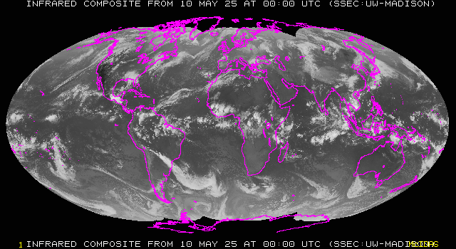
and 1800gmt Related upper level wind charts The Aviation Weather Centre offers these terrific flight level charts SIGWX) which show the position of jet streams over much of the globe (mostly Northern Hemisphere). Because upper level winds, like the jet stream, steer our weather systems, knowing where these winds are and how they are behaving helps us to understand whether systems are moving east to west quickly or whether they will stalling because of a kink in the pipe-line. Forecasts up to 18 hours in advance. Infra red imagery Infra red satellite picture of South America (focus on the land mass, rather than the South Atlantic, unfortunately). Intellicast offers this colourful composite image showing the temperature of cloud tops - red, and especially purple, being the coldest; grey the warmest. This global composite is useful for viewing all of the South Pacific because images rarely cover the entire ocean from west to east. Black and white global composite image showing infra-red pictures of clouds. Detail is lacking and this one is not as easy to understand as Intellicast's coloured version above. However, this image, processed by the Space Science Engineering Center, University of Wisconsin-Madison , is also available as a four day animated movie and this is where this tool really begins to shine! More great reading: Get the good oil at the official Volvo web site. Read all about the Jacques Vabre trans-Atlantic race . Playstation smashes the trans-Atlantic record by 44 hours by surfing the perfect front! Battle of the Open 60s in the EDS Atlantic Challenge: Which route works best We analyse the Los Angles to Honolulu Transpac, 2001 Follow the Challenge Mondial Assistance through the official web site and get a preview of weather conditions on the route. Catch up on all the past action of the recent Vendee Globe in our race archive. Re-live the action between the world's fastest multihulls in The Race Re-live the 2000 Sydney to Hobart yacht race! Break ice in the Ross Sea! Re-live the solo trans-Atlantic race of June 2000 and the Quebec to St Malo of last August.
|